UN/LOCODE hub · Ukraine
UAKIA

Kiliia

45.4333°, 29.2667°
1
Transport functions

Transport Functions

Port
UN/LOCODE

Location

Location of UAKIA
Natural Earth 10m (public domain) · Odessa · UAKIA · 45.43, 29.27GoogleOSMYandex

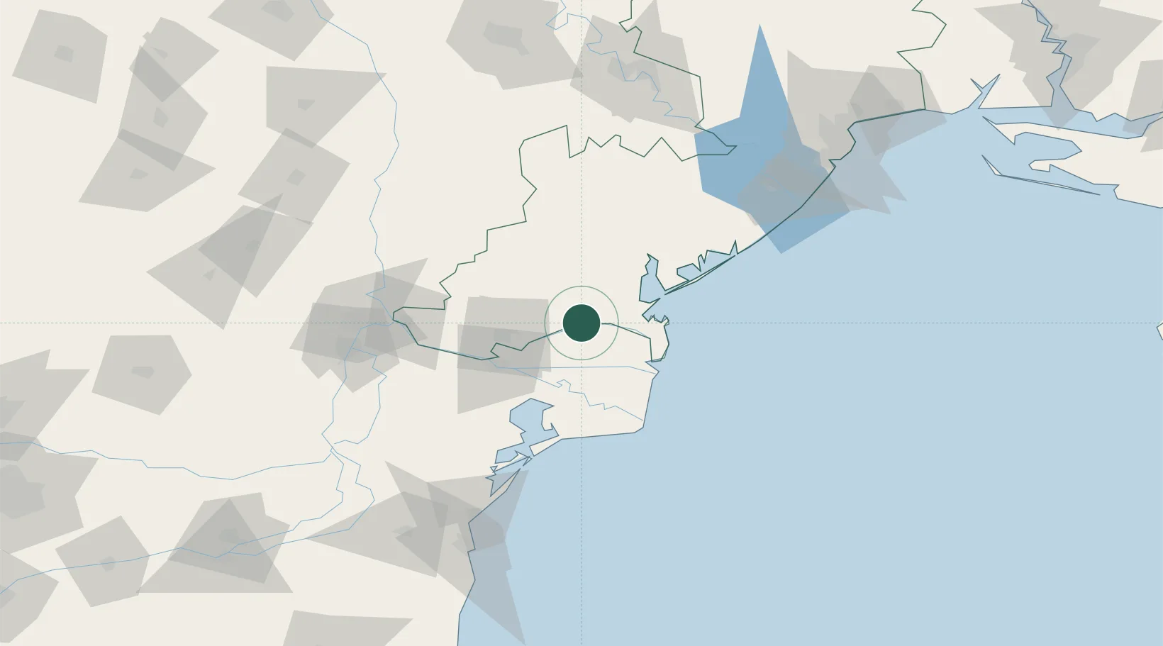
Nearby Logistics Neighbours

Cities
  1. 1Vylkove25 km
  2. 2Chilia Veche34 km
  3. 3Ust-Dunaisk/Vylkove34 km
  4. 4Izmail35 km
  5. 5Mahmudia35 km
Nearest neighbours — logibook spatial index (haversine) over the source coordinates
Ports
  1. 1Ust-Dunaisk34 km
  2. 2Izmayil34 km
  3. 3Sulina43 km
  4. 4Tulcea46 km
  5. 5Reni75 km
Nearest neighbours — logibook spatial index (haversine) over the source coordinates
Airports
  1. 1Zhovtneve Air Base52 km
  2. 2Tulcea Danube Delta Airport60 km
  3. 3Cahul International Airport90 km
  4. 4Mihail Kogălniceanu International Airport134 km
  5. 5Odesa International Airport155 km
Nearest neighbours — logibook spatial index (haversine) over the source coordinates
Trade Zones
  1. 1Free Zone Sulina41 km
  2. 2Free Enterprise Zone - Production Park Taraclia71 km
  3. 3Reni Special Economic Zone77 km
  4. 4Giurgiulesti International Free Port83 km
  5. 5Free Enterprise Zone Tvardita84 km
Nearest neighbours — logibook spatial index (haversine) over the source coordinates
DatabookThe Record of Consolidated Knowledge
Ukraine beyond logistics?
Browse databook

All Sources

LocationsUN/LOCODE
UN/LOCODE — free
Portsthe NGA World Port Index
Public domain (US gov)
AirportsOurAirports
Public domain
Trade Zonesthe World Bank SEZ database
CC BY 4.0
Trade ZonesOpen Zone Map
CC BY
← Ukraine locations