UN/LOCODE hub · Sweden
SEELO

Ellös

58.1833°, 11.4667°
2
Transport functions

Transport Functions

Port
Road
UN/LOCODE

Hub Profile

Region
O
GeoNames

Location

Location of SEELO
Natural Earth 10m (public domain) · O · SEELO · 58.18, 11.47GoogleOSMYandex

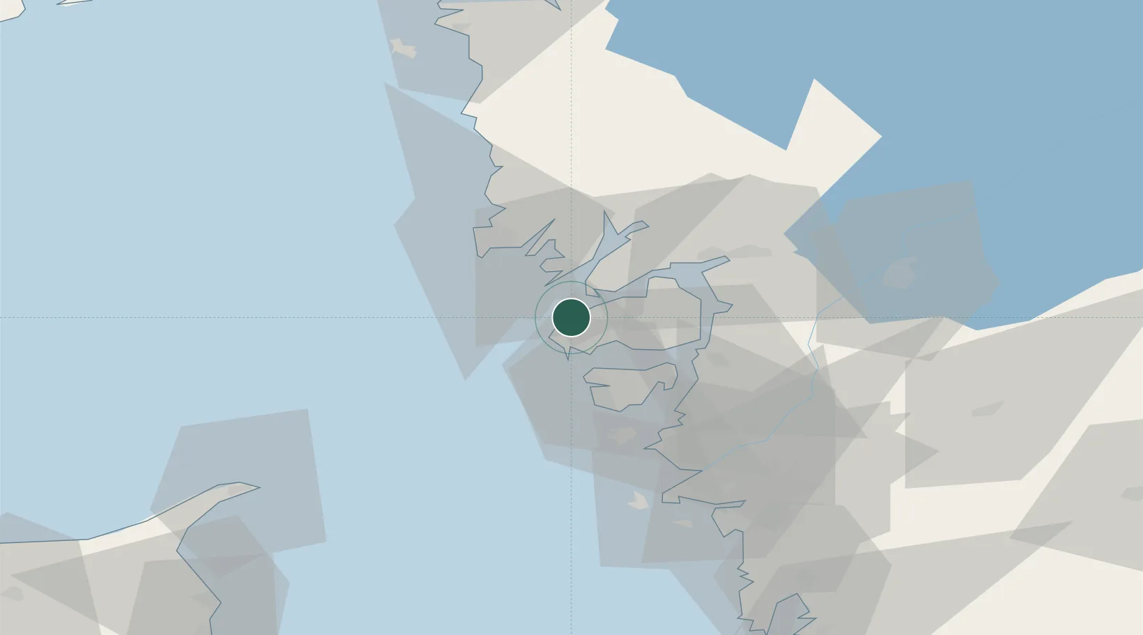
Nearby Logistics Neighbours

Cities
  1. 1Lysekil11 km
  2. 2Kyrkesund19 km
  3. 3Brofjorden19 km
  4. 4Svanesund22 km
  5. 5Brastad22 km
Nearest neighbours — logibook spatial index (haversine) over the source coordinates
Ports
  1. 1Lysekil10 km
  2. 2Brofjorden20 km
  3. 3Stenungsund23 km
  4. 4Uddevalla29 km
  5. 5Hunnebostrand30 km
Nearest neighbours — logibook spatial index (haversine) over the source coordinates
Airports
  1. 1Säve Airport51 km
  2. 2Trollhättan-Vänersborg Airport54 km
  3. 3Göteborg Landvetter Airport75 km
  4. 4Såtenäs Air Base78 km
  5. 5Råda Air Base99 km
Nearest neighbours — logibook spatial index (haversine) over the source coordinates
Trade Zones
  1. 1Gothenburg Boundless Customs Warehouse57 km
  2. 2Jönköping Free Zone162 km
  3. 3Freeport of Copenhagen- Nordhavn283 km
  4. 4MTS Malmö Transport and Spedition303 km
  5. 5Stockholm Free Zone404 km
Nearest neighbours — logibook spatial index (haversine) over the source coordinates
DatabookThe Record of Consolidated Knowledge
Sweden beyond logistics?
Browse databook

All Sources

LocationsUN/LOCODE
UN/LOCODE — free
Portsthe NGA World Port Index
Public domain (US gov)
AirportsOurAirports
Public domain
Trade Zonesthe World Bank SEZ database
CC BY 4.0
Trade ZonesOpen Zone Map
CC BY
← Sweden locations