UN/LOCODE hub · Russia
RUVCG

Vichuga

57.2000°, 41.9167°
39,071
Population
2
Transport functions

Transport Functions

Rail
Road
UN/LOCODE

Hub Profile

Place type
Provincial seat
GeoNames
Region
Ivanovo Oblast
GeoNames
Population
39,071
GeoNames
Time zone
Europe/Moscow
GeoNames
Elevation
146 m
GeoNames

Location

Location of RUVCG
Natural Earth 10m (public domain) · Ivanovo Oblast · RUVCG · 57.20, 41.92GoogleOSMYandex

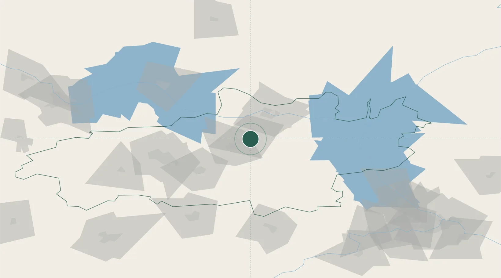
Nearby Logistics Neighbours

Cities
  1. 1Gorkino21 km
  2. 2Khropunovo34 km
  3. 3Privolzhsk42 km
  4. 4Furmanov50 km
  5. 5Kokhma59 km
Nearest neighbours — logibook spatial index (haversine) over the source coordinates
Ports
  1. 1Arkhangels'k819 km
  2. 2Severodvinsk828 km
  3. 3Mezen967 km
  4. 4Rostov-Na-Donu1126 km
  5. 5Taganrog1130 km
Nearest neighbours — logibook spatial index (haversine) over the source coordinates
Airports
  1. 1Ivanovo North Air Base59 km
  2. 2Ivanovo South Airport66 km
  3. 3Kostroma Sokerkino Airport85 km
  4. 4Golden Ring Yaroslavl International Airport113 km
  5. 5Sormovo Airfield151 km
Nearest neighbours — logibook spatial index (haversine) over the source coordinates
DatabookThe Record of Consolidated Knowledge
Russia beyond logistics?
Browse databook

All Sources

LocationsUN/LOCODE
UN/LOCODE — free
LocationsGeoNames
CC BY 4.0
Portsthe NGA World Port Index
Public domain (US gov)
AirportsOurAirports
Public domain
Trade Zonesthe World Bank SEZ database
CC BY 4.0
Trade ZonesOpen Zone Map
CC BY
← Russia locations