About
Methodology
Sources
Licensing
English
EN
English
TR
Türkçe
DE
Deutsch
FR
Français
ES
Español
IT
Italiano
PT
Português
NL
Nederlands
PL
Polski
RU
Русский
UK
Українська
CS
Čeština
RO
Română
EL
Ελληνικά
BG
Български
AR
العربية
FA
فارسی
UR
اردو
HI
हिन्दी
BN
বাংলা
ID
Bahasa Indonesia
VI
Tiếng Việt
ZH
中文
JA
日本語
KO
한국어
logibook
/
Countries
/
Poland
/
Locations
/
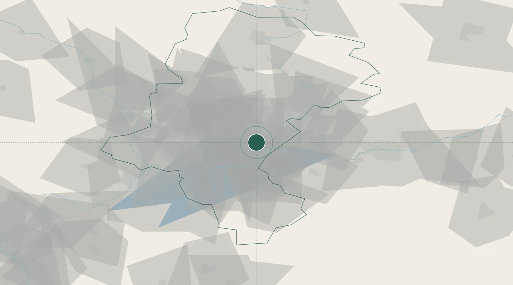
Bierun Stary
UN/LOCODE hub ·
Poland
PL
BST
Bierun Stary
50.1000°, 19.1000°
2
Transport functions
Transport Functions
Rail
Road
UN/LOCODE
Location
Natural Earth 10m (public domain) · Silesian · PLBST · 50.10, 19.10
Google ↗
OSM ↗
Yandex ↗
Nearby Logistics Neighbours
Cities
1
Bojszowy
4 km
2
Tichy
9 km
3
Gorzow
10 km
4
Oswiecim
14 km
5
Libiaz
16 km
Nearest neighbours — logibook spatial index (haversine) over the source coordinates
Ports
1
Gdansk
474 km
2
Nowy Port
481 km
3
Szczecin
484 km
4
Gdynia
494 km
5
Police
495 km
Nearest neighbours — logibook spatial index (haversine) over the source coordinates
Airports
1
Katowice Wojciech Korfanty International Airport
42 km
2
Kraków John Paul II International Airport
49 km
3
Leoš Janáček Airport Ostrava
84 km
4
Žilina-Dolný Hričov Airport
103 km
5
Poprad-Tatry Airport
141 km
Nearest neighbours — logibook spatial index (haversine) over the source coordinates
Trade Zones
1
Katowice SEZ (Katowicka SSE)
21 km
2
Silesian Center for Logistics
42 km
3
Karvinská Specialized Economic Zone
50 km
4
Kraków Technology Park
57 km
5
Mošnov Development Area
84 km
Nearest neighbours — logibook spatial index (haversine) over the source coordinates
Data
book
The Record of Consolidated Knowledge
Poland beyond logistics?
Browse databook
→
All Sources
Locations
UN/LOCODE
UN/LOCODE — free
↗
Ports
the NGA World Port Index
Public domain (US gov)
↗
Airports
OurAirports
Public domain
↗
Trade Zones
the World Bank SEZ database
CC BY 4.0
↗
Trade Zones
Open Zone Map
CC BY
↗
← Poland locations