UN/LOCODE hub · France
FRROG

Rognac

43.4833°, 5.2333°
12,254
Population
1
Transport functions

Transport Functions

Rail
UN/LOCODE

Hub Profile

Place type
Populated place
GeoNames
Region
Provence-Alpes-Côte d'Azur
GeoNames
Population
12,254
GeoNames
Time zone
Europe/Paris
GeoNames
Elevation
37 m
GeoNames

Location

Location of FRROG
Natural Earth 10m (public domain) · Provence-Alpes-Côte d'Azur · FRROG · 43.48, 5.23GoogleOSMYandex

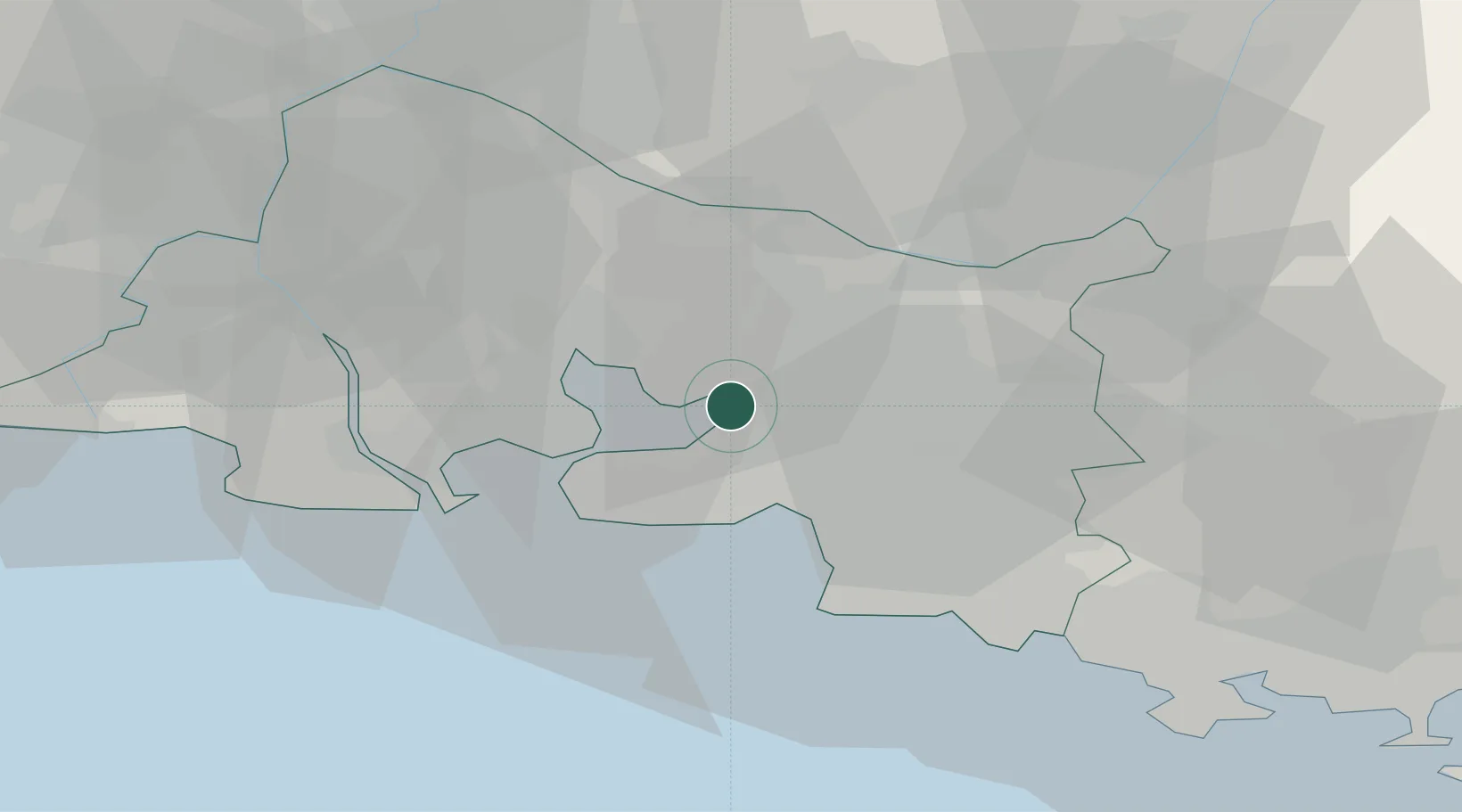
Nearby Logistics Neighbours

Cities
  1. 1Berre-l'Étang6 km
  2. 2Coudoux8 km
  3. 3La Fare-les-Oliviers8 km
  4. 4Gignac-la-Nerthe9 km
  5. 5Le Rove12 km
Nearest neighbours — logibook spatial index (haversine) over the source coordinates
Ports
  1. 1Marseille21 km
  2. 2Port-de-Bouc22 km
  3. 3Fos29 km
  4. 4Port Saint Louis Du Rhone35 km
  5. 5Toulon70 km
Nearest neighbours — logibook spatial index (haversine) over the source coordinates
Airports
  1. 1Marseille Provence Airport5 km
  2. 2Salon-de-Provence (BA 701) Air Base17 km
  3. 3Istres-Le Tubé Air Base25 km
  4. 4Le Castellet Airport52 km
  5. 5Avignon Caumont airport54 km
Nearest neighbours — logibook spatial index (haversine) over the source coordinates
Trade Zones
  1. 1ZFU Marseille 15e et 16e20 km
  2. 2ZFU Saint-Barthélémy, Le Canet, Delorme-Paternelle23 km
  3. 3ZFU Avignon62 km
  4. 4ZFU La Seyne-sur-Mer67 km
  5. 5ZFU Toulon70 km
Nearest neighbours — logibook spatial index (haversine) over the source coordinates
DatabookThe Record of Consolidated Knowledge
France beyond logistics?
Browse databook

All Sources

LocationsUN/LOCODE
UN/LOCODE — free
LocationsGeoNames
CC BY 4.0
Portsthe NGA World Port Index
Public domain (US gov)
AirportsOurAirports
Public domain
Trade Zonesthe World Bank SEZ database
CC BY 4.0
Trade ZonesOpen Zone Map
CC BY
← France locations