UN/LOCODE hub · Spain
ESSXX

Sangenjo

42.4000°, -8.8167°
2
Transport functions

Transport Functions

Port
Road
UN/LOCODE

Hub Profile

Region
PO
GeoNames

Location

Location of ESSXX
Natural Earth 10m (public domain) · PO · ESSXX · 42.40, -8.82GoogleOSMYandex

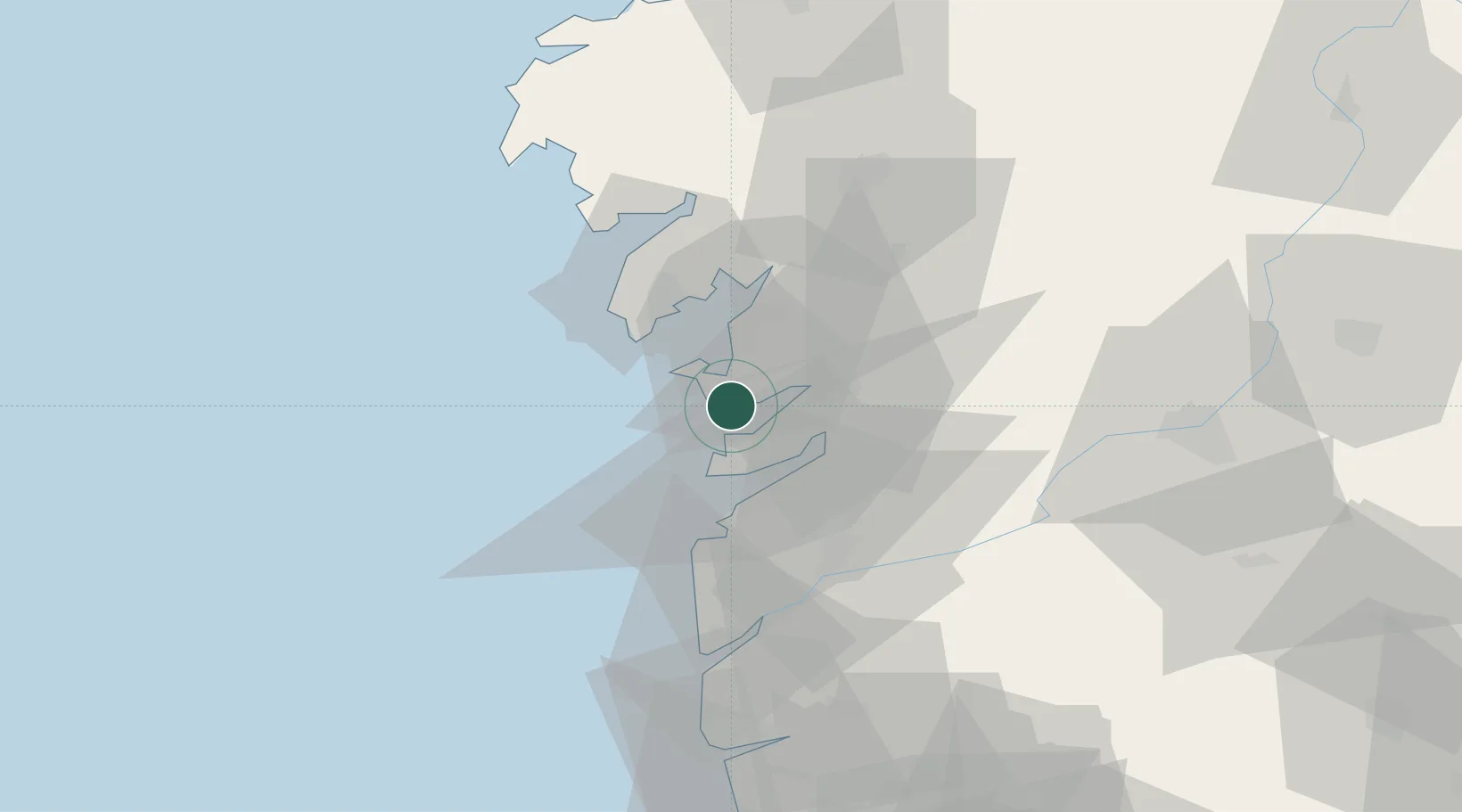
Nearby Logistics Neighbours

Cities
  1. 1Portonovo0 km
  2. 2Sanxenxo1 km
  3. 3Castrelo9 km
  4. 4Marin10 km
  5. 5Marin, Pontevedra10 km
Nearest neighbours — logibook spatial index (haversine) over the source coordinates
Ports
  1. 1Marin10 km
  2. 2Vigo20 km
  3. 3Villagarcia De Arosa23 km
  4. 4Viana Do Castelo78 km
  5. 5La Coruna113 km
Nearest neighbours — logibook spatial index (haversine) over the source coordinates
Airports
  1. 1Vigo Airport24 km
  2. 2Santiago-Rosalía de Castro Airport64 km
  3. 3Braga Municipal Aerodrome96 km
  4. 4A Coruña Airport107 km
  5. 5Vilar de Luz Airfield127 km
Nearest neighbours — logibook spatial index (haversine) over the source coordinates
Trade Zones
  1. 1Zona Franca de Vigo20 km
  2. 2Depósito Franco de La Coruña112 km
  3. 3Zona Livre Tecnológica Masotinhos137 km
  4. 4VGP Park Santa Maria da Feira165 km
  5. 5Depósito Franco de Gijón285 km
Nearest neighbours — logibook spatial index (haversine) over the source coordinates
DatabookThe Record of Consolidated Knowledge
Spain beyond logistics?
Browse databook

All Sources

LocationsUN/LOCODE
UN/LOCODE — free
Portsthe NGA World Port Index
Public domain (US gov)
AirportsOurAirports
Public domain
Trade Zonesthe World Bank SEZ database
CC BY 4.0
Trade ZonesOpen Zone Map
CC BY
← Spain locations