UN/LOCODE hub · Canada
CABDF

Bedford

44.7167°, -63.6833°
21,474
Population
4
Transport functions

Transport Functions

Port
Rail
Road
Multimodal
UN/LOCODE

Hub Profile

Place type
Populated place
GeoNames
Region
Nova Scotia
GeoNames
Population
21,474
GeoNames
Time zone
America/Halifax
GeoNames
Elevation
25 m
GeoNames

Location

Location of CABDF
Natural Earth 10m (public domain) · Nova Scotia · CABDF · 44.72, -63.68GoogleOSMYandex

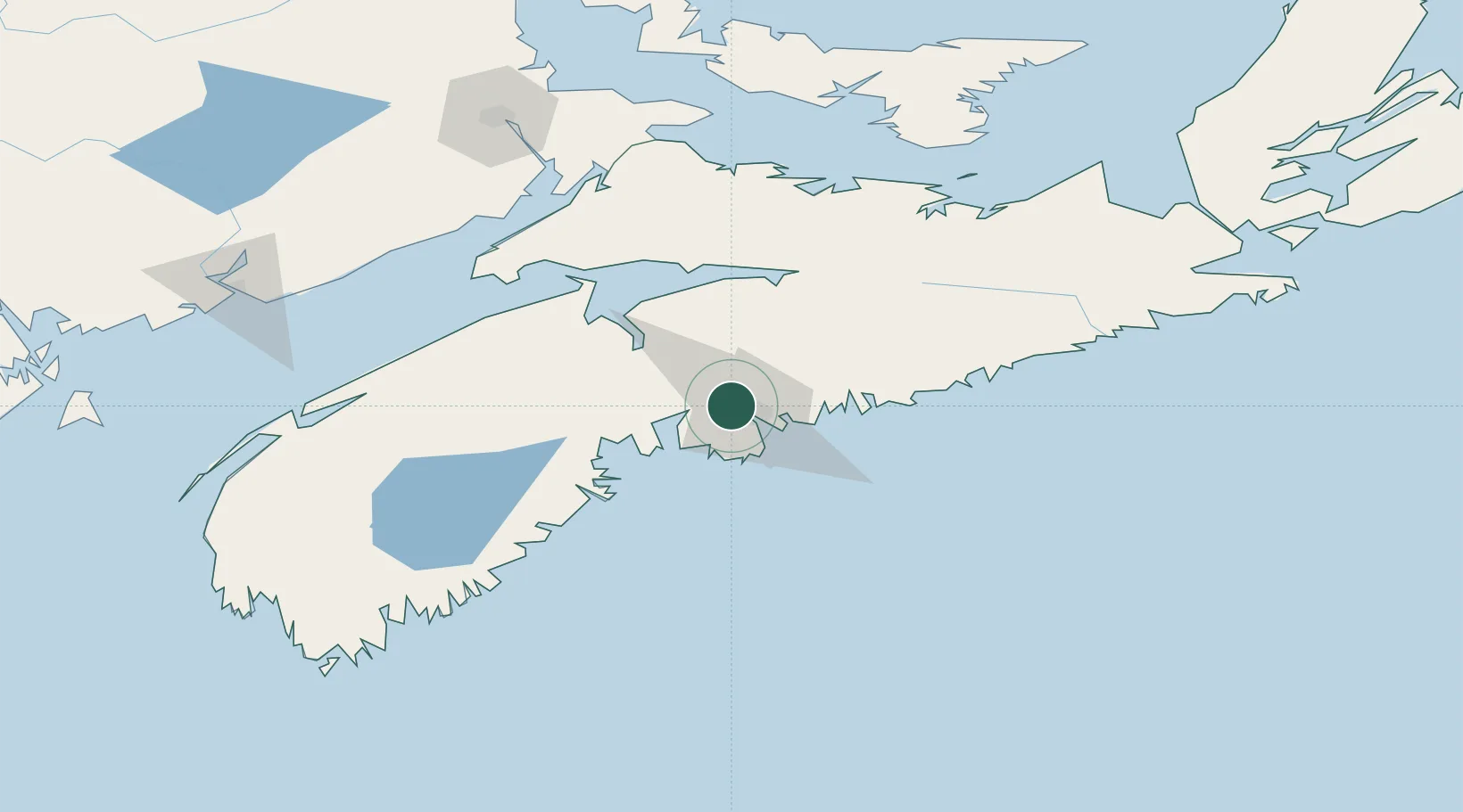
Nearby Logistics Neighbours

Cities
  1. 1Halifax10 km
  2. 2Dartmouth10 km
  3. 3Waverley10 km
  4. 4Fall River12 km
  5. 5Seabright23 km
Nearest neighbours — logibook spatial index (haversine) over the source coordinates
Ports
  1. 1Halifax11 km
  2. 2Musquodoboit Harbour43 km
  3. 3Windsor48 km
  4. 4Liverpool (Brooklyn)108 km
  5. 5Pictou130 km
Nearest neighbours — logibook spatial index (haversine) over the source coordinates
Airports
  1. 1Halifax / Stanfield International Airport23 km
  2. 2CFB Greenwood102 km
  3. 3Fox Harbour Airport129 km
  4. 4Digby / Annapolis Regional Airport167 km
  5. 5Greater Moncton Roméo LeBlanc International Airport174 km
Nearest neighbours — logibook spatial index (haversine) over the source coordinates
Trade Zones
  1. 1Halifax Gateway11 km
  2. 2Saint John198 km
  3. 3Cape Breton Regional Municipality Foreign Trade Zone280 km
  4. 4FTZ No. 058 Bangor405 km
  5. 5FTZ No. 179 Madawaska459 km
Nearest neighbours — logibook spatial index (haversine) over the source coordinates
DatabookThe Record of Consolidated Knowledge
Canada beyond logistics?
Browse databook

All Sources

LocationsUN/LOCODE
UN/LOCODE — free
LocationsGeoNames
CC BY 4.0
Portsthe NGA World Port Index
Public domain (US gov)
AirportsOurAirports
Public domain
Trade Zonesthe World Bank SEZ database
CC BY 4.0
Trade ZonesOpen Zone Map
CC BY
← Canada locations