UN/LOCODE hub · Poland
PLZIC

Dziecmierowo

52.2667°, 17.2667°
1
Transport functions

Transport Functions

Port
UN/LOCODE

Hub Profile

Place type
Populated place
GeoNames
Region
Greater Poland
GeoNames
Time zone
Europe/Warsaw
GeoNames
Elevation
79 m
GeoNames

Location

Location of PLZIC
Natural Earth 10m (public domain) · Greater Poland · PLZIC · 52.27, 17.27GoogleOSMYandex

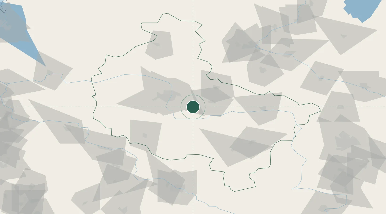
Nearby Logistics Neighbours

Cities
  1. 1Sroda Wielkopolska6 km
  2. 2Robakowo14 km
  3. 3Swarzedz20 km
  4. 4Orzechowo21 km
  5. 5Ksiaz Wielkopolsk22 km
Nearest neighbours — logibook spatial index (haversine) over the source coordinates
Ports
  1. 1Szczecin223 km
  2. 2Police232 km
  3. 3Kolobrzeg245 km
  4. 4Darlowo247 km
  5. 5Gdansk250 km
Nearest neighbours — logibook spatial index (haversine) over the source coordinates
Airports
  1. 1Krzesiny Military Air Base22 km
  2. 2Poznań-Ławica Airport35 km
  3. 3Powidz Military Air Base42 km
  4. 4Inowroclaw Military Air Base95 km
  5. 5Zielona Góra-Babimost Airport101 km
Nearest neighbours — logibook spatial index (haversine) over the source coordinates
Trade Zones
  1. 1Legnica SEZ (Legnicka SSE)143 km
  2. 2Łódź SEZ (ōódzka SSE)162 km
  3. 3Wałbrzych SEZ INVEST-PARK (Wałbrzyska SSE)174 km
  4. 4Kostrzyń-Słubice SEZ182 km
  5. 5Kamienna Góra186 km
Nearest neighbours — logibook spatial index (haversine) over the source coordinates
DatabookThe Record of Consolidated Knowledge
Poland beyond logistics?
Browse databook

All Sources

LocationsUN/LOCODE
UN/LOCODE — free
Portsthe NGA World Port Index
Public domain (US gov)
AirportsOurAirports
Public domain
Trade Zonesthe World Bank SEZ database
CC BY 4.0
Trade ZonesOpen Zone Map
CC BY
← Poland locations