UN/LOCODE hub · Malta
MTMRI

Mriehel

35.8833°, 14.4500°
1
Transport functions

Transport Functions

Multimodal
UN/LOCODE

Hub Profile

Region
06
GeoNames

Location

Location of MTMRI
Natural Earth 10m (public domain) · 06 · MTMRI · 35.88, 14.45GoogleOSMYandex

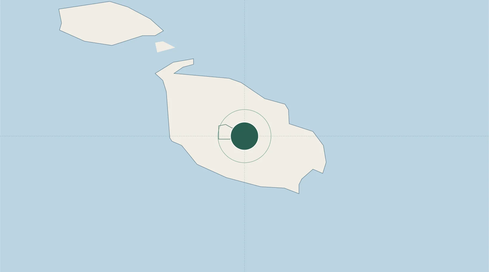
Nearby Logistics Neighbours

Cities
  1. 1Attard2 km
  2. 2Msida2 km
  3. 3Balzan2 km
  4. 4Hamrun3 km
  5. 5Pietà3 km
Nearest neighbours — logibook spatial index (haversine) over the source coordinates
Ports
  1. 1Valletta Harbors6 km
  2. 2Marsaxlokk12 km
  3. 3Pozzallo99 km
  4. 4Gela133 km
  5. 5Licata142 km
Nearest neighbours — logibook spatial index (haversine) over the source coordinates
Airports
  1. 1Malta International Airport6 km
  2. 2Xewkija Heliport23 km
  3. 3Comiso Airport125 km
  4. 4Lampedusa Airport171 km
  5. 5Sigonella Navy Air Base174 km
Nearest neighbours — logibook spatial index (haversine) over the source coordinates
Trade Zones
  1. 1Malta Freeport11 km
  2. 2Sicily Special Economic Zone Area187 km
  3. 3Zwara-Abu-Kemmash Free Trade Zone396 km
  4. 4Misurata Free Zone400 km
  5. 5Ben Guerdane Economic Free Zone404 km
Nearest neighbours — logibook spatial index (haversine) over the source coordinates
DatabookThe Record of Consolidated Knowledge
Malta beyond logistics?
Browse databook

All Sources

LocationsUN/LOCODE
UN/LOCODE — free
Portsthe NGA World Port Index
Public domain (US gov)
AirportsOurAirports
Public domain
Trade Zonesthe World Bank SEZ database
CC BY 4.0
Trade ZonesOpen Zone Map
CC BY
← Malta locations