UN/LOCODE hub · Greece
GRAAI

Ágioi Anárgyroi

39.1333°, 21.0167°
756
Population
1
Transport functions

Transport Functions

Multimodal
UN/LOCODE

Hub Profile

Place type
Populated place
GeoNames
Region
Epirus
GeoNames
Population
756
GeoNames
Time zone
Europe/Athens
GeoNames
Elevation
36 m
GeoNames

Location

Location of GRAAI
Natural Earth 10m (public domain) · Epirus · GRAAI · 39.13, 21.02GoogleOSMYandex

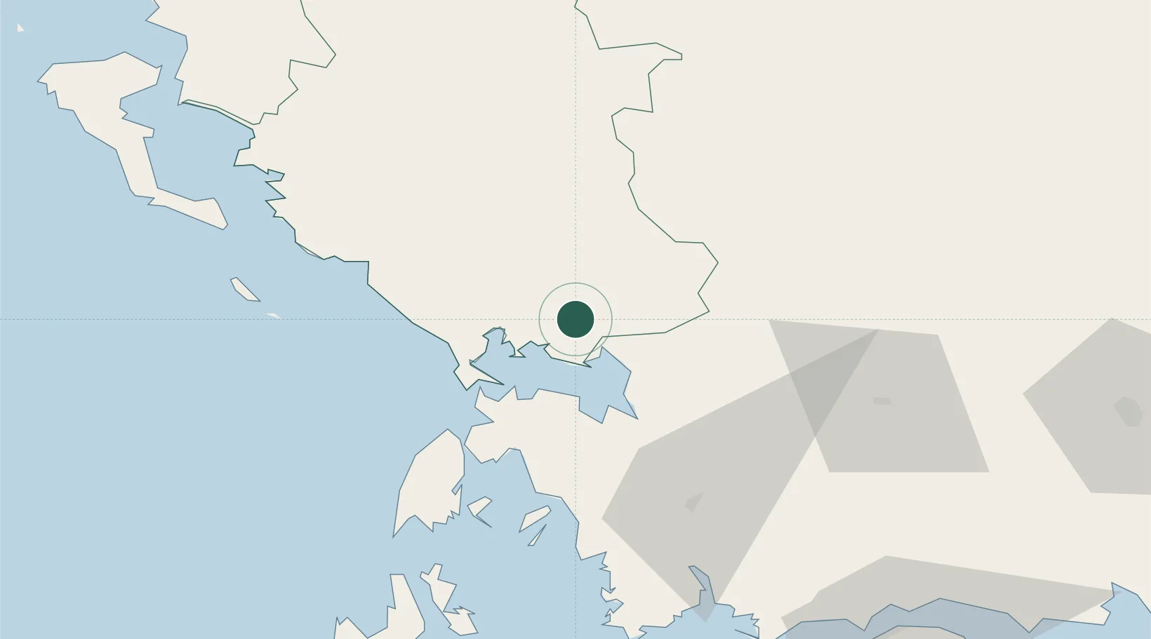
Nearby Logistics Neighbours

Cities
  1. 1Menidi14 km
  2. 2Aktio Vonitsas31 km
  3. 3Amfilochía32 km
  4. 4Lefkáda (Lefkás)43 km
  5. 5Nidhríon55 km
Nearest neighbours — logibook spatial index (haversine) over the source coordinates
Ports
  1. 1Preveza31 km
  2. 2Astakos73 km
  3. 3Mesolongion92 km
  4. 4Kerkira108 km
  5. 5Argostolion114 km
Nearest neighbours — logibook spatial index (haversine) over the source coordinates
Airports
  1. 1Aktion National Airport32 km
  2. 2Ioannina King Pyrrhus National Airport65 km
  3. 3Corfu Ioannis Kapodistrias International Airport108 km
  4. 4Patras Araxos Agamemnon Airport115 km
  5. 5Kefallinia Airport121 km
Nearest neighbours — logibook spatial index (haversine) over the source coordinates
Trade Zones
  1. 1Free Zone of Platigiali (Astakos Etoloakarnanias)73 km
  2. 2Gjirokastër Freezone127 km
  3. 3Përmet Freezone136 km
  4. 4Korçë Freezone168 km
  5. 5Pogradec Freezone198 km
Nearest neighbours — logibook spatial index (haversine) over the source coordinates
DatabookThe Record of Consolidated Knowledge
Greece beyond logistics?
Browse databook

All Sources

LocationsUN/LOCODE
UN/LOCODE — free
LocationsGeoNames
CC BY 4.0
Portsthe NGA World Port Index
Public domain (US gov)
AirportsOurAirports
Public domain
Trade Zonesthe World Bank SEZ database
CC BY 4.0
Trade ZonesOpen Zone Map
CC BY
← Greece locations