UN/LOCODE hub · Greece
GRAMF

Amfilochía

38.8667°, 21.1667°
4,022
Population
1
Transport functions

Transport Functions

Port
UN/LOCODE

Hub Profile

Place type
District seat
GeoNames
Region
West Greece
GeoNames
Population
4,022
GeoNames
Time zone
Europe/Athens
GeoNames
Elevation
80 m
GeoNames

Location

Location of GRAMF
Natural Earth 10m (public domain) · West Greece · GRAMF · 38.87, 21.17GoogleOSMYandex

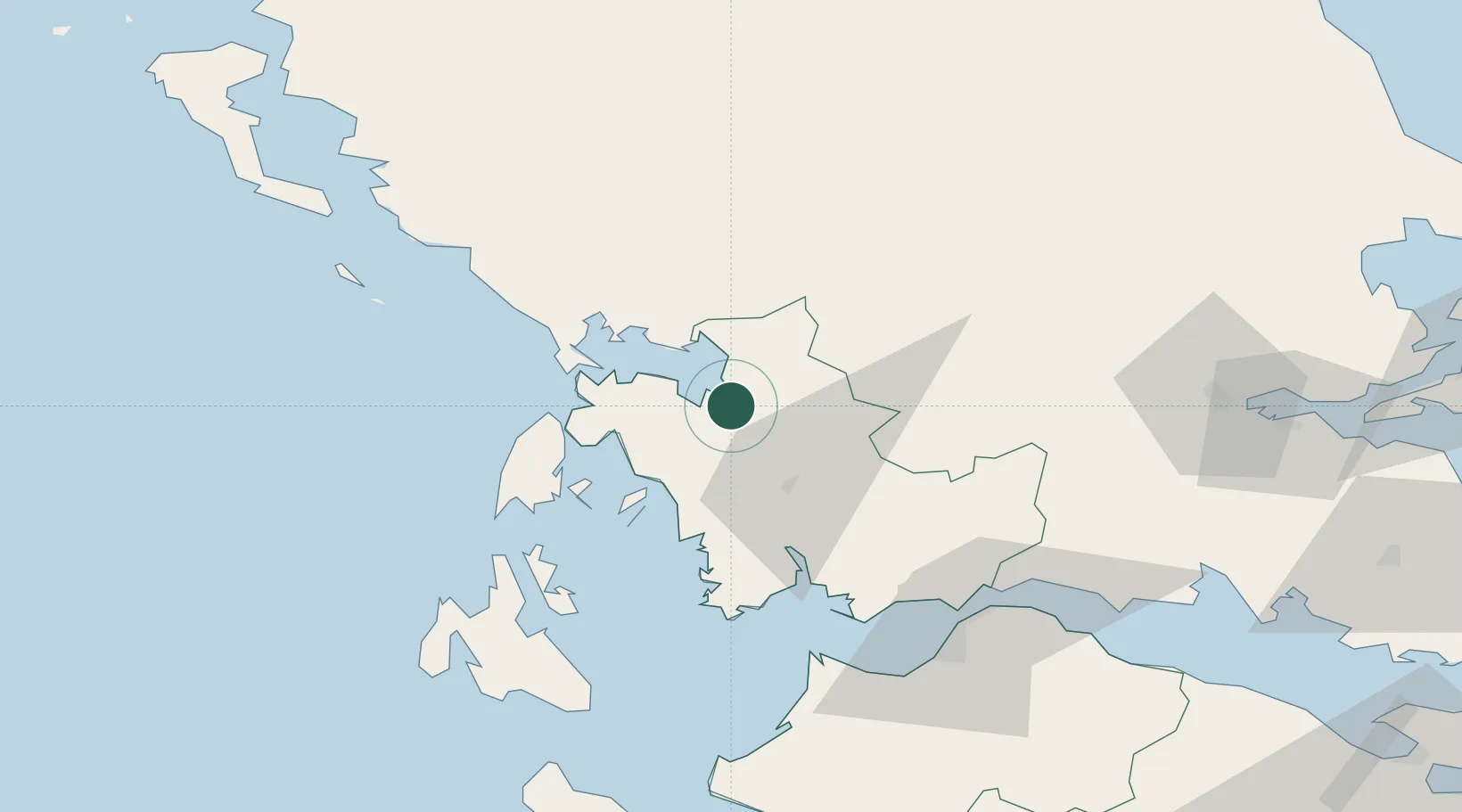
Nearby Logistics Neighbours

Cities
  1. 1Menidi19 km
  2. 2Ágioi Anárgyroi32 km
  3. 3Kalamos Island (Lefkada)35 km
  4. 4Aktio Vonitsas37 km
  5. 5Astakós38 km
Nearest neighbours — logibook spatial index (haversine) over the source coordinates
Ports
  1. 1Preveza37 km
  2. 2Astakos43 km
  3. 3Mesolongion60 km
  4. 4Patrai84 km
  5. 5Argostolion95 km
Nearest neighbours — logibook spatial index (haversine) over the source coordinates
Airports
  1. 1Aktion National Airport35 km
  2. 2Patras Araxos Agamemnon Airport83 km
  3. 3Ioannina King Pyrrhus National Airport97 km
  4. 4Kefallinia Airport101 km
  5. 5Andravida Air Base106 km
Nearest neighbours — logibook spatial index (haversine) over the source coordinates
Trade Zones
  1. 1Free Zone of Platigiali (Astakos Etoloakarnanias)44 km
  2. 2Gjirokastër Freezone159 km
  3. 3Përmet Freezone168 km
  4. 4Korçë Freezone200 km
  5. 5Pogradec Freezone230 km
Nearest neighbours — logibook spatial index (haversine) over the source coordinates
DatabookThe Record of Consolidated Knowledge
Greece beyond logistics?
Browse databook

All Sources

LocationsUN/LOCODE
UN/LOCODE — free
LocationsGeoNames
CC BY 4.0
Portsthe NGA World Port Index
Public domain (US gov)
AirportsOurAirports
Public domain
Trade Zonesthe World Bank SEZ database
CC BY 4.0
Trade ZonesOpen Zone Map
CC BY
← Greece locations