UN/LOCODE hub · Italy
ITREA

Olmo di Creazzo

45.8667°, 11.8000°
1
Transport functions

Transport Functions

Rail
UN/LOCODE

Hub Profile

Region
VI
GeoNames

Location

Location of ITREA
Natural Earth 10m (public domain) · VI · ITREA · 45.87, 11.80GoogleOSMYandex

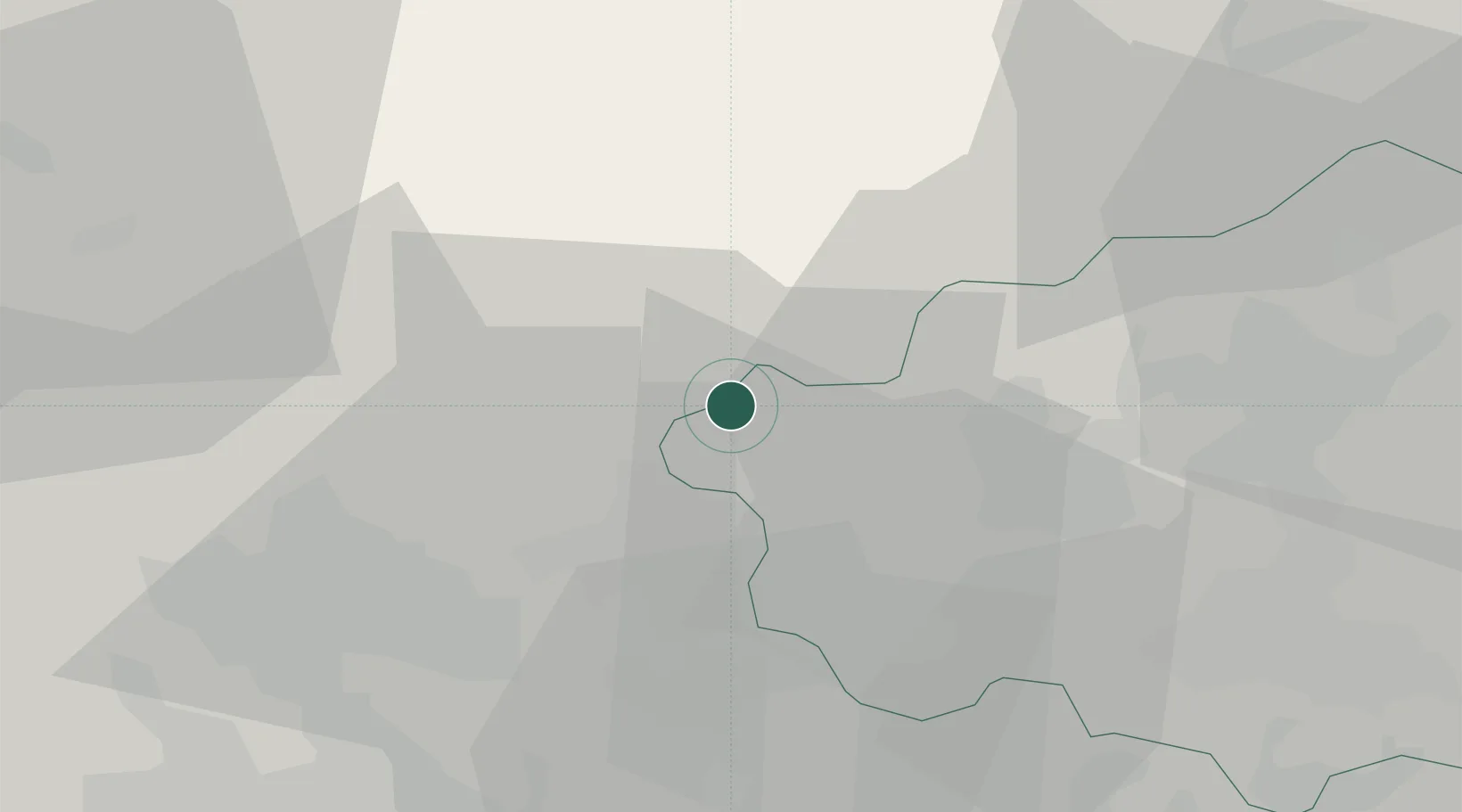
Nearby Logistics Neighbours

Cities
  1. 1Castelcucco6 km
  2. 2Cavaso del Tomba7 km
  3. 3Alano Di Piave8 km
  4. 4Semonzo8 km
  5. 5Solagna9 km
Nearest neighbours — logibook spatial index (haversine) over the source coordinates
Ports
  1. 1Porto Di Lido-Venezia70 km
  2. 2Porto Di Chioggia81 km
  3. 3Nogaro107 km
  4. 4Grado118 km
  5. 5Monfalcone136 km
Nearest neighbours — logibook spatial index (haversine) over the source coordinates
Airports
  1. 1Istrana Air Base30 km
  2. 2Treviso Airport39 km
  3. 3Padova Gino Allegri Airfield53 km
  4. 4Trento-Mattarello Airport55 km
  5. 5Venice Marco Polo Airport59 km
Nearest neighbours — logibook spatial index (haversine) over the source coordinates
Trade Zones
  1. 1Consorzio Zona Industriale e Porto Fluviale di Padova54 km
  2. 2Free Port of Venice63 km
  3. 3Livigno Free Trade Zone150 km
  4. 4Free Port of Trieste154 km
  5. 5Port of Pula Free Zone194 km
Nearest neighbours — logibook spatial index (haversine) over the source coordinates
DatabookThe Record of Consolidated Knowledge
Italy beyond logistics?
Browse databook

All Sources

LocationsUN/LOCODE
UN/LOCODE — free
Portsthe NGA World Port Index
Public domain (US gov)
AirportsOurAirports
Public domain
Trade Zonesthe World Bank SEZ database
CC BY 4.0
Trade ZonesOpen Zone Map
CC BY
← Italy locations